Commonwealth War Cemeteries in Iraq
6 Squadron RAF, WW1 Aviation and My Books
Battle of Messines - Aerial Reconnaissance Photos by 6 Squadron Royal Air Force
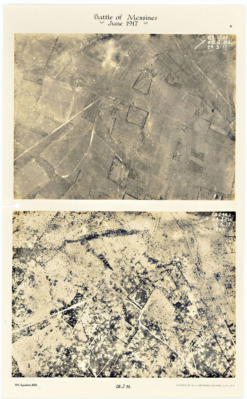
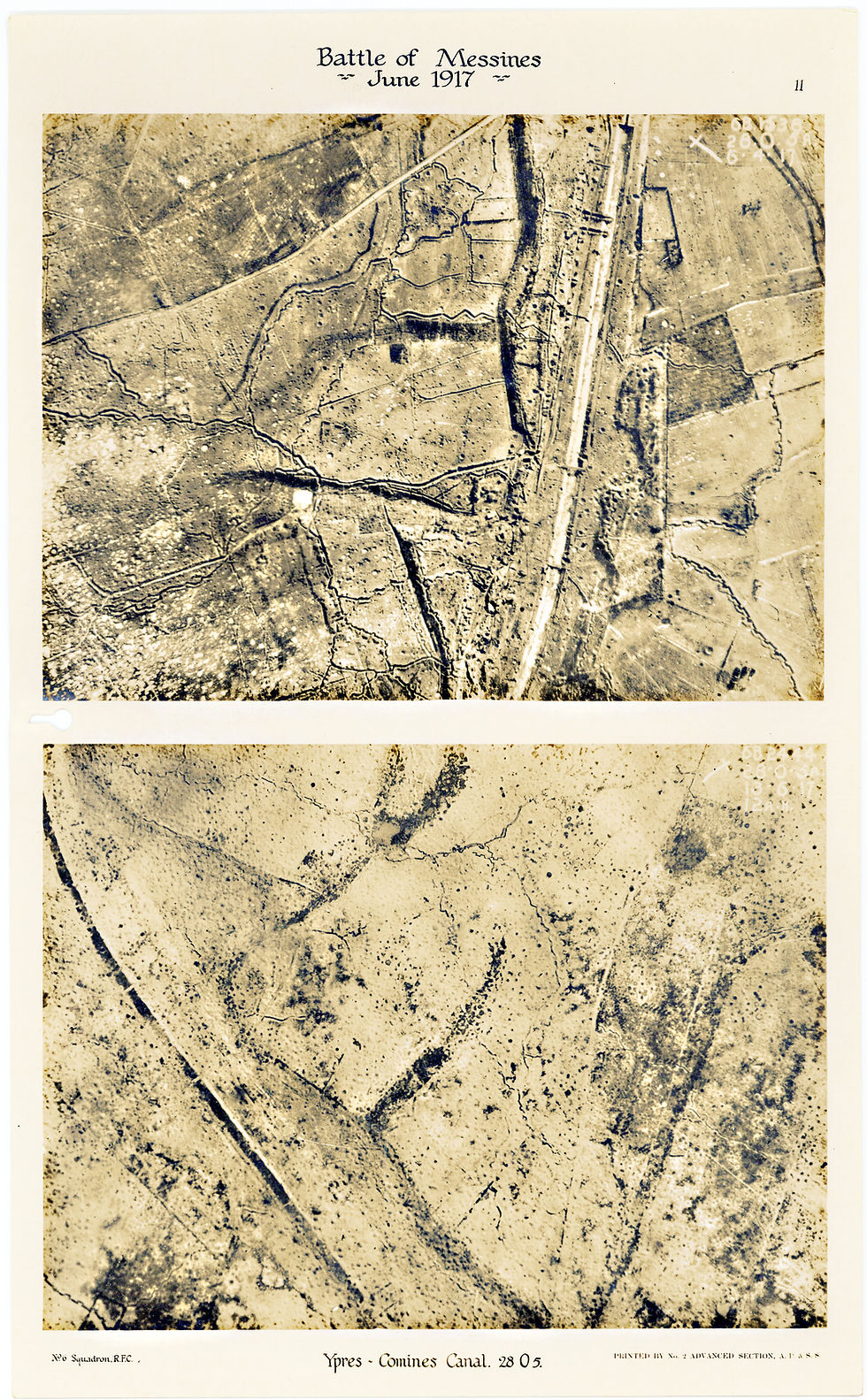
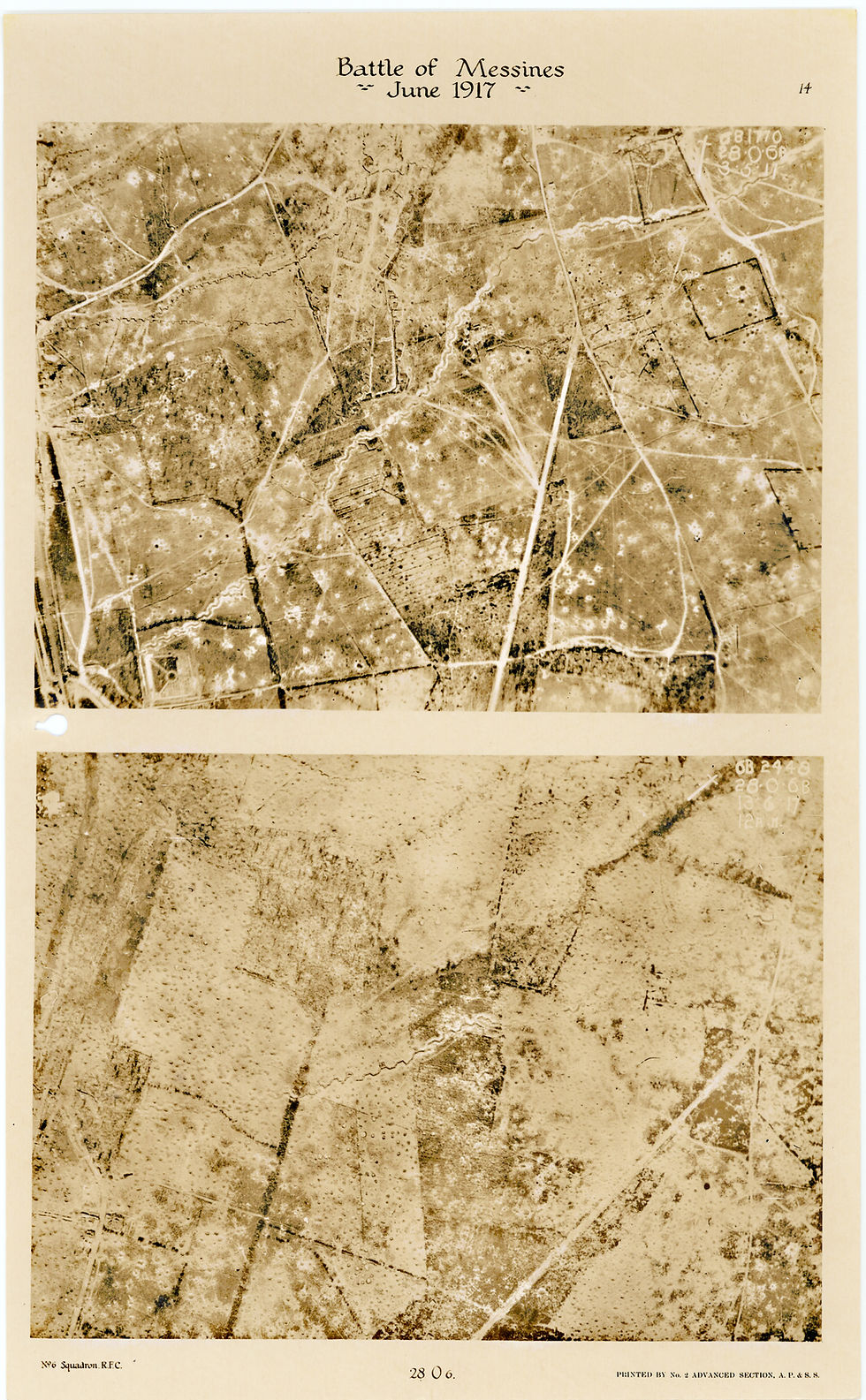
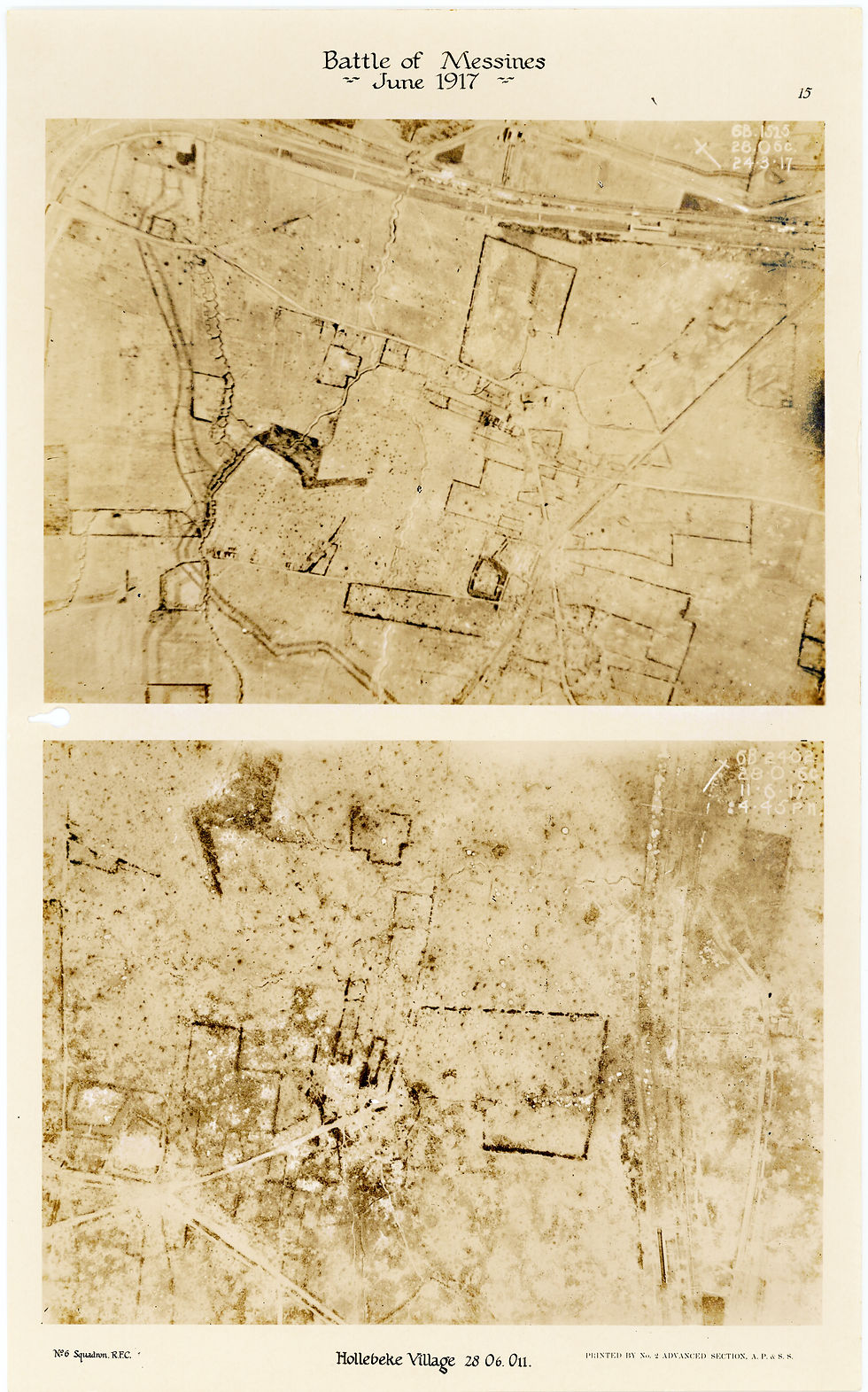
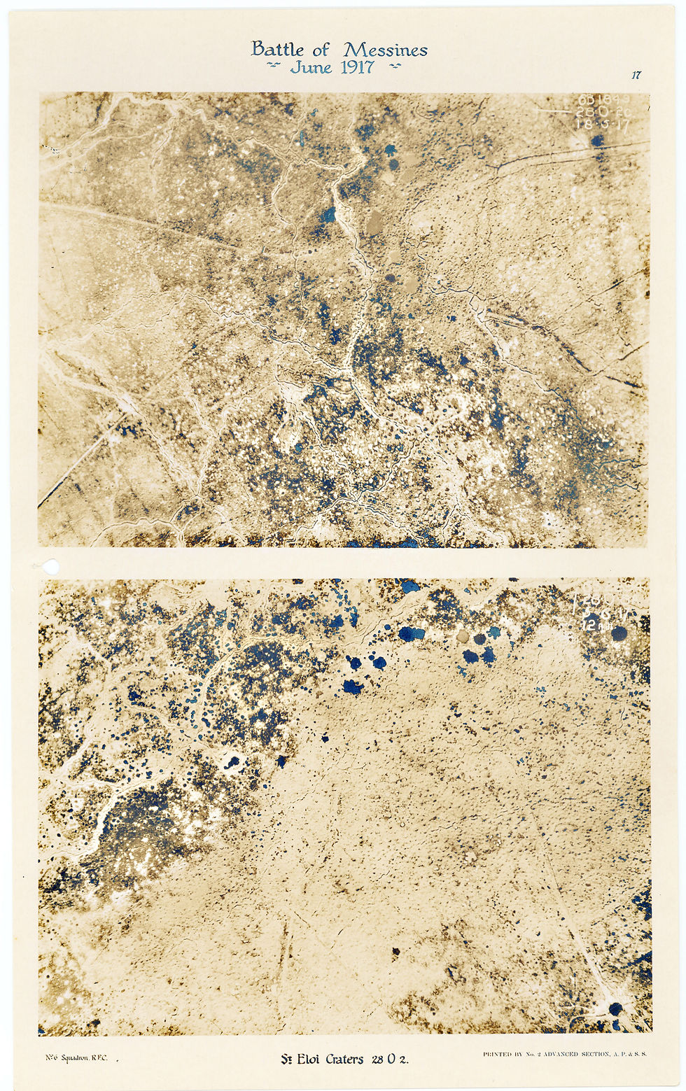
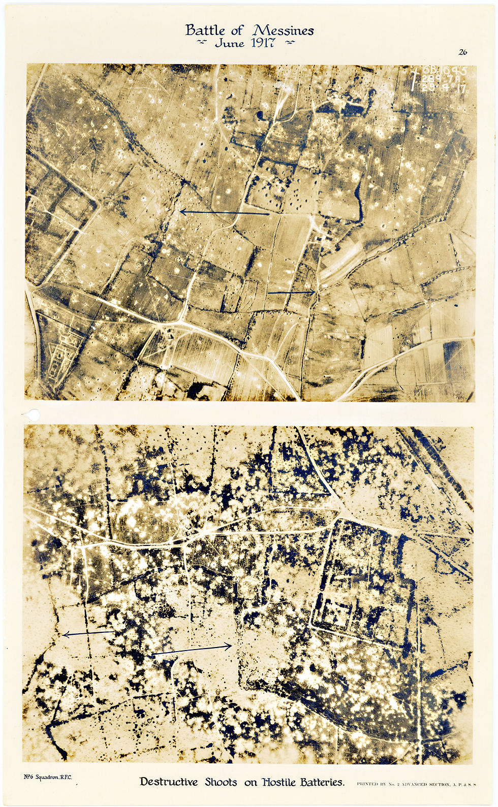
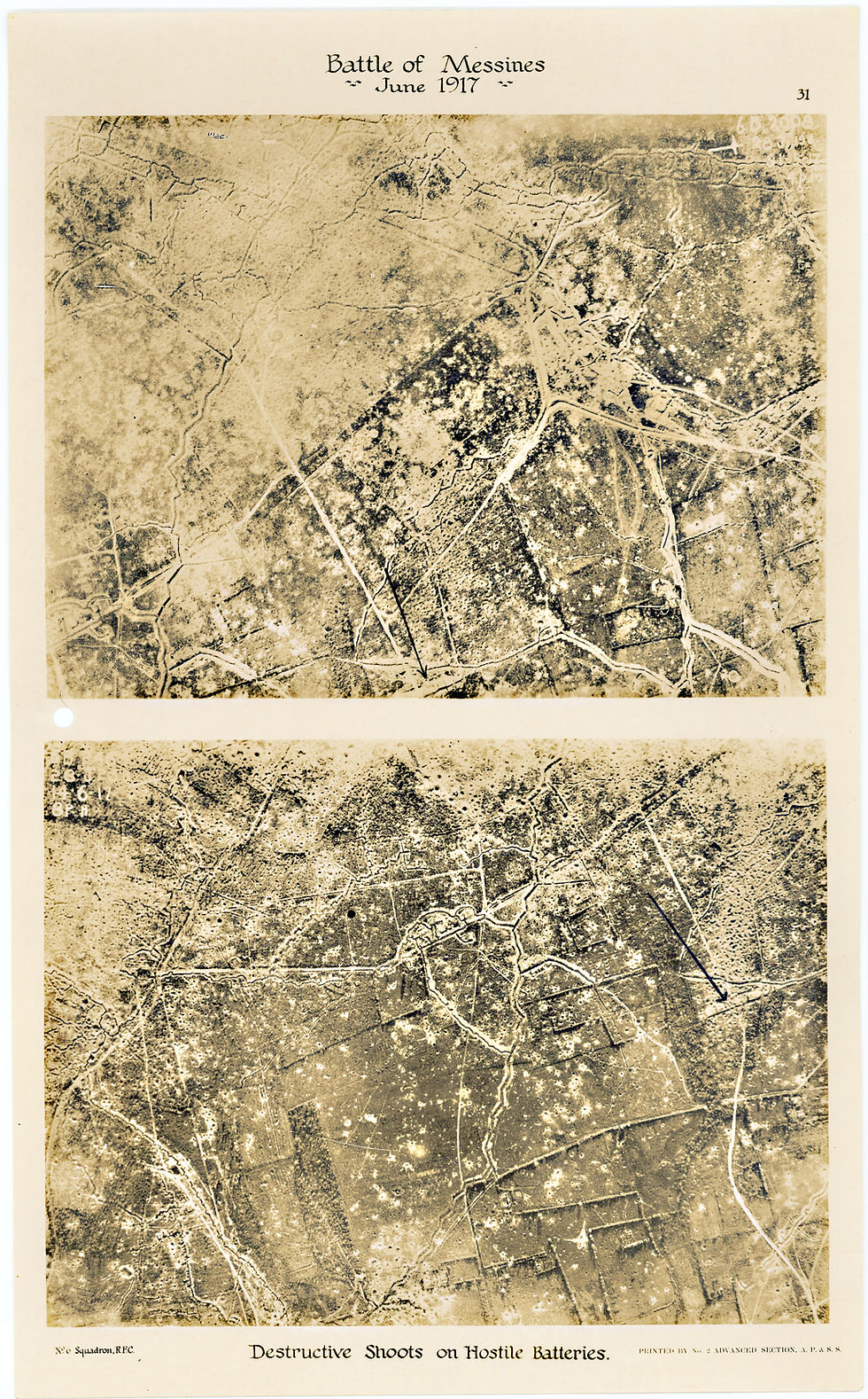
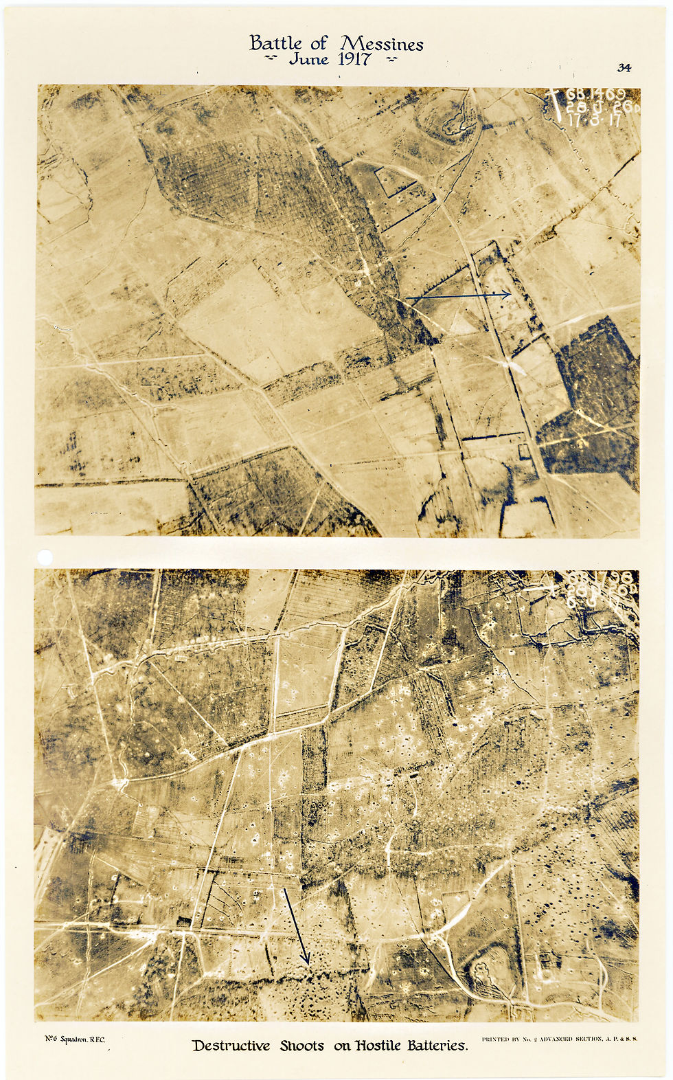
This section of my website show the contents (43 pages, 2 photos per page) of an aerial dossier produced by 6 Squadron as part of its operations during WW1 over the Western Front. The photographic images (two to a page) show the effect of the allied bombardment before and after the Battle of Messines in June 1917 when the allies exploded 19 mines beneath the German lines on the ridge around Messines. Each of the 86 photographs is marked with a date and time stamp as well as mapping coordinates. If you know the name of the location you are looking for, select the appropriate images from the MESSINES sub menu, otherwise simply scroll through the images displayed in sequence immediately below the Aerial Photos Summary Chart.
In late 2016, David Weekes kindly sent me part of his WW1 photographic collection from the UK so that I could use the photographs in my own personal research as well as help others gain knowledge regarding aerial warfare and photography on the western front during WW1. He also expressed the desire that the documents eventually be donated to the British National Archives. To date I have been unsuccessful in my attempts to have the 6 Squadron "The Battle of Messines" aerial photograph dossier, printed by the No 2 Advanced Section A P & S S - Army Printing and Stationery Services - included in the AIR 1 collection alongside other 6 Squadron documentation that has survived the test of time, the sole reason given to me being the fact that the document has never been processed by the Air Historical Branch. Rather than deny others access to these important historical photographs that provide a direct comparison of the landscape of the region around Messines before and after the British attack on the German positions on the morning of 7th June 1917.
For anyone unfamiliar with the military gridding system used by the Allies during WW1, I have reproduced two images here, the first taken from my book, For God, England and Ethel (showing the coordinates of two artillery 'shoots' carried out by 6 Squadron aircraft) and the second a summary of the areas of the Western Front around Ypres and Messines that are covered by one or more of the 86 photographs.
For anyone interested in seeing 'then' and 'now' photographs of the area around Palingbeek, I recommend you visit Hugh Shipman's website